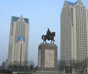
The city is home to the basketball club Liaoning Flying Leopards of the Chinese Basketball Association. The club brought forth several players of China's national basketball team. It plays its home games at the Benxi Gymnasium.
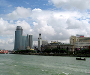
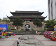
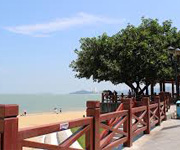
Xiamen (Mandarin pronunciation: [ɕjâmə̌n]), also historically known as Amoy /əˈmɔɪ/, POJ Hokkien: ε̄-mûiⁿ; Ē-mn̂g, is a major city on the southeast (Taiwan Strait) coast of the People's Republic of China. It is administered as a sub-provincial city of Fujian province, with an area of 1,699.39 square kilometres (656.14 sq mi) and population of 3,531,347 at the 2010 Census. The city's urban area includes the old urban island area and covers all six districts of Xiamen (Huli, Siming, Jimei, Tong'an, Haicang and recently Xiang'an), and has a total urban population of 1,861,289. It also borders Quanzhou to the north and Zhangzhou making this a unique built up area of more than five million people. The Jinmen (Kinmen) Islands administered by the Republic of China (Taiwan) are less than 10 kilometres (6.2 mi) away.
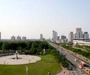
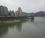
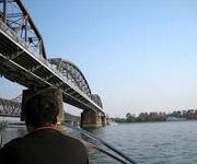
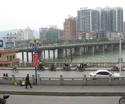
Zhenjiang (Chinese Postal Map Romanisation: Chenkiang; simplified Chinese: 镇江; traditional Chinese: 鎮江; pinyin: Zhènjiāng) is a city in Jiangsu province, in eastern China. Sitting on the southern bank of the Yangtze River, Zhenjiang is governed as a Prefecture-level city; it borders the provincial capital of Nanjing to the west, Changzhou to the east, and Yangzhou across the river to the north. Once known as Jingjiang (Chinese: 京江; Chinese Postal Map Romanisation: Kingkiang) or Jingkou (Chinese: 京口; Chinese Postal Map Romanisation: Kingkow), Zhenjiang is today an important transportation hub, owing to its location near the intersection of the Yangtze River and the Grand Canal.
Zhoushan (help·info); formerly transliterated as Chusan, is a prefecture-level city in northeastern Zhejiang province of Eastern China. One of the two prefecture-level cities of the People's Republic of China consisting solely of islands (the other is Sansha in Hainan, however its territory is in dispute), it lies across the mouth of the Hangzhou Bay, and is separated from the mainland by a narrow body of water. On 8 July 2011 the central government approved Zhoushan's as Zhoushan Archipelago New Area a state-level new area. At the 2010 census, its population was 1,121,261 whom 842,989 lived in the built-up area made of Dinghai and Putuo counties.
Jiaozuo (Chinese: 焦作; pinyin: Jiāozuò; Postal map spelling: Tsiaotso) is a prefecture-level city in northern Henan province, People's Republic of China. Sitting on the northern bank of the Yellow River, it borders the provincial capital of Zhengzhou to the south, Xinxiang to the east, Jiyuan to the west, Luoyang to the southwest, and the province of Shanxi to the north. Its population was 3,540,101 at the 2010 census whom 1,301,732 live in the built-up area made of 4 urban districts (Jiefang, Shanyang, Zhongzhan and Macun) and Bo'ai County being urbanized. Jiaozuo enjoys a humid subtropical climate with continental climate influences,winters are cool and relatively dry while summers are hot and often rainy.average temperature ranges from 0.3 °C in January to 27.5 °C in July.Extremes exist from -22.4 °C to 43.6 °C °C,precipitation averages 659mm.
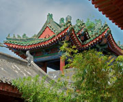
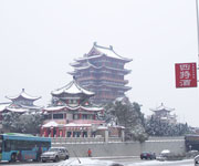
Chengde (Chinese: 承德; pinyin: Chéngdé), previously known as Jehol or Rehe (simplified Chinese: 热河; traditional Chinese: 熱河; pinyin: Rèhé), is a prefecture-level city in Hebei province, situated northeast of Beijing. It is best known as the site of the Mountain Resort, a vast imperial garden and palace formerly used by the Qing emperors as summer residence. The urban center had a population of approximately 450,000 as of 2009.
Langfang (Chinese: 廊坊; pinyin: Lángfáng), is a prefecture-level city of Hebei province, located approximately midway between Beijing and Tianjin. At the 2010 census, its population was 4,358,839 whom 868,066 lived in the built-up (or metro) area made of Guangyang and Anci districts. Its total area is around 6,417.28 km2 (2,477.73 sq mi). Langfang borders Baoding to the southwest, Cangzhou to the south (both prefecture-level cities of Hebei), Beijing to the north and Tianjin to the east. Sanhe City and Dachang Hui County are now conurbated with Beijing belonging to the same built-up area. It is the smallest prefecture-level city of Hebei by land area.
Qinhuangdao is a port city and prefecture-level city in northeastern Hebei province, People's Republic of China. It is about 300 km (190 mi) east of Beijing, on the Bohai Sea, the innermost gulf of the Yellow Sea. Its population during the 2010 census was 2,987,605, with 1,029,670 living in the built-up (or metro) area made of 3 urban districts.
Zhangjiakou, also known also by several other names, is a prefecture-level city in northwestern Hebei province, bordering Beijing to the southeast, Inner Mongolia to the north and west and Shanxi to the southwest. At the 2010 census, its population was 4,345,485 inhabitants on 36,861.56 square kilometres (14,232.33 sq mi). The built-up (or metro) area made of Qiaoxi, Qiaodong Districts and Wanquan County largely being conurbated had 838,978 inhabitants in 2010 on 1412.7 km2. Due to its position on several important transport arteries, it is a critical transport node for travel between Hebei and Inner Mongolia and connecting northwest China, Mongolia, and Beijing.
Baotou (Mongolian: ᠪᠤᠭᠤᠲᠤ ᠬᠣᠲᠠ Buɣutu qota; Chinese: 包头市) also known as Bugthot is the largest industrial city in the Inner Mongolia Autonomous Region of the People's Republic of China. Governed as a prefecture-level city, its built-up (or metro) area made up of 5 urban districts is home to 2,070,801 inhabitants with a total population of over 2.65 million accounting for counties under its jurisdiction. The city's Mongolian name means "place with deer", and an alternate name is "Lucheng" (鹿城; Lùchéng), meaning "Deer City".
Chifeng (Chinese: 赤峰市), also known as Ulanhad (Mongolian: ᠤᠯᠠᠭᠠᠨᠬᠠᠳᠠ ᠬᠣᠲᠠ (Улаанхад хот) Ulaɣanqada qota [ʊlaːnxad xɔt], "red cliff"), is a prefecture-level city in southeastern Inner Mongolia, People's Republic of China. It borders Xilin Gol League to the north and west, Tongliao to the northeast, Chaoyang (Liaoning) to the southeast, and Chengde (Hebei) to the south. The city has a total administrative area of 90,275 square kilometres (34,855 sq mi) and has a population of 4,341,245 inhabitants. As of the 2010 census, 1,094,970 of these residents reside within in the urban districts of Hongshan, Yuanbaoshan and Songshan. However, a large part of Songshan is still rural and Yuanbaoshan is a de facto separate town 27 kilometers away from the core district of Chifeng. The city was the administrative centre of the defunct Ju Ud League (昭乌达盟; ᠵᠤᠤ ᠤᠳᠠ ᠴᠢᠭᠤᠯᠭᠠᠨ).
Hohhot (Chinese: 呼和浩特; pinyin: Hūhéhàotè; Mongolian: ᠬᠥᠬᠡᠬᠣᠲᠠ Kökeqota; Khalkha: Хөх хот Khökh khot; also romanized as Huhehot or Huhhot), abbreviated Hushi(Chinese: 呼市; pinyin: Hūshì), formerly known as Kweisui (simplified Chinese: 归绥; traditional Chinese: 歸綏; pinyin: Gūisūi), is the capital of the Inner Mongolian Autonomous Region in North China, serving as the region's administrative, economic, and cultural centre. Its population was 2,866,615 inhabitants at the 2010 census whom 1,980,774 lived in the built-up (or metro) area made up of 4 urban districts. The name of the city in Mongolian means "Blue City"—Kuku-Khoto in Mongolian—although it is also wrongly referred to as the "Green City." The color blue in Mongol culture is associated with the sky, eternity and purity; in Chinese, the name can be translated as Qīng Chéng (Chinese: 青城), literally, "Blue/Green City."
Hulunbuir or Hūlúnbèi'ěr (Mongolian: ᠬᠥᠯᠥᠨ ᠪᠤᠶᠢᠷ ᠬᠣᠲᠠ Kölön Buyir qota; Chinese: 呼伦贝尔市) is a region that is governed as a prefecture-level city in northeastern Inner Mongolia, in the People's Republic of China. Its administrative center is located at Hailar District, its largest urban area. Major scenic features are the high steppes of the Hulun Buir grasslands, the Hulun and Buir lakes (the latter partially in Mongolia), and the Khingan range. Hulun Buir borders Russia to the north and west, Mongolia to the south and west, Heilongjiang province to the east and Hinggan League to the direct south. Hulunbuir is a linguistically diverse area: next to Mandarin Chinese, Mongolian dialects such as Khorchin and Buryat, the Mongolic language Dagur and some Tungusic languages are spoken there.
Tongliao (Mongolian: ᠲᠦᠩᠯᠢᠶᠣᠤ ᠬᠣᠲᠠ Tüŋliyou qota; Chinese: 通辽市) is a prefecture-level city in eastern Inner Mongolia, People's Republic of China. The area is 59,535 square kilometres (22,987 sq mi) and population is 3,139,153 (as of 2010); the city proper has 898,895 inhabitants (2010). The city was the administrative centre of the defunct Jirem League (哲里木盟; ᠵᠢᠷᠢᠮ ᠠᠶᠢᠮᠠᠭ). The original Mongolian name for Tongliao city proper (i.e. Horqin District) is Bayisingtu ('having buildings'), while the original name of the prefecture-level city is Jirem. The Mongolian dialect spoken in this area is Khorchin Mongolian.
Jinzhong (simplified Chinese: 晋中; traditional Chinese: 晉中; pinyin: Jìnzhōng) is a prefecture-level city with 3,249,425 inhabitants at the 2010 census in east central Shanxi province of the People's Republic of China. Before 1999, what is now Jinzhong was Jinzhong Prefecture, with its capital at the county-level city of Yuci (Chinese: 榆次; pinyin: Yúcì; Wade–Giles: Yu-tz'u). In 1999, Jinzhong Prefecture became Jinzhong Prefecture-level City, and Yuci County-level City became Yuci District (a county-level district). Yuci district is now part of Taiyuan built up area home to 3,848,151 inhabitants in 2010.
Linfen (simplified Chinese: 临汾; traditional Chinese: 臨汾; pinyin: Línfén) is a prefecture-level city in southern Shanxi province, People's Republic of China. It is situated along the banks of the Fen River. It has an area of 20,275 square kilometres (7,828 sq mi) and according to the 2010 Census, a population of 4,316,612 inhabitants of which 944,050 live in the built-up (or metro) area made up of Yaodu urban district. It was known as Pingyang (平阳) during the Spring and Autumn Period. In 2006, New York based Blacksmith Institute listed Linfen as one of the ten most polluted cities in the world. Prior to 1978, Linfen was famous for its spring water, greenery and rich agriculture and therefore nicknamed "The Modern Fruit and Flower Town". Since then it has been developing into a main industrial center for coal mining, which has been seriously damaging the city's environment, air quality, farming, health and its past status as a green village.

Taiyuan (Chinese: 太原; pinyin: Tàiyuán [tʰaɪ̂ɥɛ̌n], also known as Bing (并), Jinyang (晋阳)) is the capital and largest city of North China's Shanxi province.[2] At the 2010 census, it had a total population of 4,201,591 inhabitants on 6,959 km2 (2,687 sq mi), from whom 3,212,500 are urban on 1,460 km2 (560 sq mi). The name of the city literally means "Great Plains", referring to the location where the Fen River leaves the mountains. The city is located at the centre of the province with an East-West span of 144 km and a North-South span of 107 km.
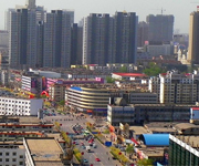
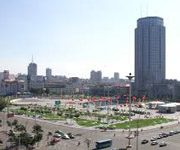
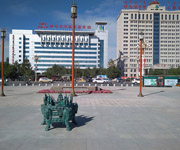
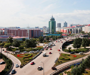
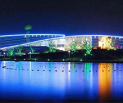
Benxi (Chinese: 本溪; pinyin: Běnxī) is a prefecture-level city located in the east of Liaoning province, People's Republic of China, south-southeast of Shenyang. Its population was 1,709,538 at the 2010 census whom 1,011,377 lived in the built-up area made of 3 urban districts (Pinshan, Xihu and Mingshan). It was founded as a metallurgical center in 1915. Benxi Iron and Steel Company ("Bengang") is the largest employer in the city, and used to be the fourth-largest steel company in China. The second-largest industry in Benxi is coal mining. Benxi has pollution problems due to steel production and coal mining. During the disaster of Air France flight AF447, Benxi Iron and Steel Company lost 5 employees, including the executive Chen Chiping who was the wife of Liaoning's provincial governor.
Dandong (simplified Chinese: 丹东; traditional Chinese: 丹東; pinyin: Dāndōng), previously known as Andong and Antung, is a prefecture-level city in southeastern-eastern Liaoning province, and is the largest Chinese border city, facing Sinuiju, North Korea across the Yalu River, which demarcates the Sino-Korean border. To the southwest of the city, the river flows into Korea Bay. Dandong has therefore had a dynamic history because of its strategic location for the northeast's rich natural resources and because of its convenient access to the ocean. It is designated as a major export production centre for the province, and is a port city connected by rail with Shenyang and Sinuiju. A significant amount of trade with North Korea flows through the city. The size of the administrative city (prefecture) is 14,981.4 square kilometres (5,784.4 sq mi); as of 2010, the built-up area made of 3 urban districts is 830 square kilometres (320 sq mi) in size and had 865,576 inhabitants. The administrative city covers around 2.45 million inhabitants as of 2010 census. The Hushan Great Wall, the far eastern end of the Great Wall of China, is located here.
Fushun (simplified Chinese: 抚顺; traditional Chinese: 撫順; pinyin: Fǔshùn, formerly romanised as Fouchouen, using French spelling) is a prefecture level city in Liaoning province, China, about 45 km (28 mi) east of Shenyang, with a population of 2,138,090 inhabitants (2010 census) and a total area of 11,271 km2 (4,352 sq mi), 713 km2 (275 sq mi) of which is the city proper. Situated on the Hun River ("muddy river"), it is one of the industrial and economic development hubs in Liaoning.

Fuxin (Chinese: 阜新; pinyin: Fùxīn) is a prefecture-level city in northwestern Liaoning province, People's Republic of China. The total population of the prefecture at the 2010 census is 1,819,339, of whom 669,317 are resident in the built up area, which comprises four urban districts, collectively known as 'Fuxin City'. Fuxin has a monsoon-influenced humid continental climate (Köppen Dwa), with long, cold but dry winters and hot, humid summers. A majority of the annual precipitation falls in July and August alone.
Liaoyang (simplified Chinese: 辽阳; traditional Chinese: 遼陽; pinyin: Liáoyáng) is a prefecture-level city of east-central Liaoning province, People's Republic of China, situated on the T'ai-tzu River and, together with Anshan, forms a metro area of 2,057,200 inhabitants in 2010. It is approximately one hour south of Shenyang, the provincial capital, by car. Liaoyang is home to Liaoning University's College of Foreign Studies and a number of vocational colleges. The city hosts a limited number of professional basketball and volleyball games in a modern sports facility.

Jinzhou (simplified Chinese: 锦州; traditional Chinese: 錦州; pinyin: Jǐnzhōu), is a prefecture-level city of Liaoning province, People's Republic of China. It is a geographically strategic city located in the "Liaoxi Corridor" (辽西走廊), which connects land transportation between North China and Northeast China. Jinzhou is China's northernmost seaport and the coastal economic center of West Liaoning on the north-western shore of the Bohai Sea. The total area under the jurisdiction of Jinzhou is 10,111 square kilometres (3,904 sq mi), most of which is rural, encompassing a coastline of 97.7 km (60.7 mi). It is one of the biggest cities in Liaoning with a population of 3,126,463 at the 2010 census, of whom 1,091,799 reside in the built-up area made of 3 urban districts.
Panjin (simplified Chinese: 盘锦; traditional Chinese: 盤錦; pinyin: Pánjǐn) is a prefecture-level city and a major oil production centre of Liaoning province, People's Republic of China, and is situated on the northern coast of Liaodong Bay of the Bohai Gulf. It borders Anshan to the northeast and east, Yingkou across the Liao River, as well as Jinzhou to the west and northwest. The city has an administrative area of 4,071 square kilometres (1,572 sq mi), is home to 1.39 million people all in the built-up area made of 2 urban districts plus Dawa and Panshan Counties being urbanized.
Baicheng (Chinese: 白城; pinyin: Báichéng; literally: "White City") is a prefecture-level city in the northwestern part of Jilin province, People's Republic of China, bordering Inner Mongolia to the north and west and Heilongjiang to the east and northeast. At the 2010 census, 2,033,058 people resided within its administrative area of 25,683 km2 (9,916 sq mi).
Jilin (Chinese: 吉林; pinyin: Jílín; former official name: Kirin) is one of the three provinces of Northeast China. Jilin borders North Korea and Russia to the east, Heilongjiang to the north, Liaoning to the south, and Inner Mongolia to the west. In ancient times, Jilin was inhabited by various peoples, notably the Xianbei, Koreans, the Mohe and the Wùjí (勿吉). Various Korean kingdoms, including the Buyeo, Goguryeo and Balhae, were established in this area. The region then fell successively under the domination of the Xiongnu, Xianbei state, Khitan Liao Dynasty, the Jurchen Jin Dynasty, and the Mongol Yuan Dynasty. During the Qing Dynasty, much of the area was under the control of the General of Jilin, whose area of control extended to the Sea of Japan to encompass much of what is Russia's Primorsky Krai today. Immigration of Han Chinese was strictly controlled.
Tonghua (Chinese: 通化; pinyin: Tōnghuà) is an industrial city in the south of Jilin province, People's Republic of China. It borders North Korea to the south and southeast, Baishan to the east, Jilin City to the north, Liaoyuan to the northwest, and Liaoning province to the west and southwest. Administratively, it is a prefecture-level city with a total population of 2,325,242 living in an area of 15,195 square kilometres (5,867 sq mi). Urban population is 506,877. It is known as one of the five medicine production centres in China.
Daqing (Chinese: 大庆; pinyin: Dàqìng; formerly spelled "Taching") (pronounced Da Tshing) is a prefecture-level city in the west of Heilongjiang province, People's Republic of China. The name literally means "Great Celebration". Daqing is known as the Oil Capital of China and has experienced a phenomenal boom since oil was discovered here in 1959. Its population was 2,904,532 at the 2010 census, of whom 1,415,268 lived in the built-up area (or metro) in 4 out of the total of 5 urban districts, i.e. (Sartu, Longfeng, Ranghulu and Honggang). Anda district of Suihua is also being conurbated next.
Heihe (Chinese: 黑河; pinyin: Hēihé; "Black River") is a prefecture-level city of northern Heilongjiang province, People's Republic of China, located on the Russian border, on the south bank of the Amur River, across the river from Blagoveshchensk. Heihe has an urban population of about 211,313, while the total population of the prefecture-level city is 1,673,893. Heihe marks the northeast terminus of the Heihe–Tengchong Line, which is sometimes used to divide China into east and west.
Jixi (Chinese: 鸡西; pinyin: Jīxī) is a city in southeastern Heilongjiang Province, People's Republic of China. At the 2010 census, 1,862,165 people resided within its administrative area of 22,488.47 square kilometres (8,682.85 sq mi) and 757,647 in its built-up (or metro) area made up of 3 out of 6 urban districts (including Jiguan, Hengshan and Chengzihe). Jixi is on the Muling River about 30 km (19 mi) from the border with Russia's Primorsky Krai and 120 km (75 mi) from Khanka Lake. The mayor of Jixi is Zhu Deyi (朱德义) since July 2009. The area is one of the important coal mining bases in China. A crater on asteroid 253 Mathilde was named after the city.
Jiamusi (Manchu: Giyamusi, Chinese: 佳木斯; pinyin: Jiāmùsī; formerly Kiamusze) is a prefecture-level city in eastern Heilongjiang province, People's Republic of China. Located along the middle and lower reaches of the Songhua River, it faces Russia's Khabarovsk Krai across the Ussuri River and the Amur River. In 2007 Jiamusi had a GDP of RMB 34.1 billion with a 14.3% growth rate. Its population was 2,552,097 at the 2010 census whom 881,711 lived in the built up area made of 4 urban districts.
Mudanjiang (Chinese: 牡丹江; pinyin: Mǔdānjiāng; Manchu: Mudan bira) is a prefecture-level city in southernmost Heilongjiang province, People's Republic of China. It was called Botankou when it was under Japanese occupation. It serves as a regional communications hub with a railway junction and an international airport connecting with several major Chinese cities as well as Seoul, Korea. Mudanjiang is also an important border city, located only 248 km (154 mi) from Vladivostok, Russia. In 2011 Mudanjiang had a GDP of RMB 93.48 billion with a 15.1% growth rate. Its population is 2,798,723 at the 2010 census whom 965,154 live in the built-up (or metro) area made of 4 urban districts. In 2007, the city is named China's top ten livable cities by Chinese Cities Brand Value Report, which was released at 2007 Beijing Summit of China Cities Forum.
Qiqihar (simplified Chinese: 齐齐哈尔; traditional Chinese: 齊齊哈爾; pinyin: Qíqíhāěr; Manchu: Cicigar; formerly Tsitsihar) is one of the 13 Larger Municipalities in China, and the second largest city in the Heilongjiang province, People's Republic of China. The built-up (or metro) area made up of Longsha, Tiefeng and Jianhua districts had 979,517 inhabitants, while the total population of the prefecture-level city was 5,367,003 at the 2010 census. These are mainly Han Chinese, though the city is also home to thirty-four minorities including Manchu, Daur, and Mongolians.[2] Close to Qiqihar are numerous wetlands and the Zhalong Nature Reserve, famous in China for being home to numerous red-crowned cranes.
Bengbu (Chinese: 蚌埠; pinyin: Bèngbù; Wade–Giles: Peng-pu) is a mid-sized city in northern Anhui Province, China. Its built-up (or metro) area made of 4 urban districts has nearly one million residents, though the Prefecture-level city under its jurisdiction had 3,164,467 registered residents at the 2010 census. Its name means "Oyster Wharf" in Chinese, echoing its former reputation as a freshwater pearl fishery. The city's urban agglomeration is about to include Huaiyuan county, which is under its jurisdiction, as well as Fengyang county in Chuzhou municipality. This contiguous built-up area would have approximately 2.6 million residents.
Hefei, formerly known as Hofei, Luzhou, or Luchow, is the capital and largest city of Anhui Province in Eastern China. A prefecture-level city, it is the political, economic, and cultural centre of Anhui. Located in the central portion of the province, it borders Huainan to the north, Chuzhou to the northeast, Chaohu to the southeast and Lu'an to the west. Hefei has an area of 11,434.25 km2 (4,414.79 sq mi) and, at the 2013 census, a population of 7,611,000 inhabitants. Its built-up area ("metro") was home to 5,031,123 inhabitants at the 2010 census encompassing all urban districts and Feidong and Feixi counties largely being urbanized.
Huaibei (Chinese: 淮北; pinyin: Huáiběi) is a prefecture-level city in northern Anhui Province, People's Republic of China. It borders Suzhou to the east, Bengbu to the south, Bozhou to the west, and the province of Henan to the north. The population was 2,114,276 inhabitants at the 2010 census, all in the built-up area, comprising 3 urban districts and Suixi County largely being built.
Huainan (Chinese: 淮南; pinyin: Huáinán) is a prefecture-level city with 2,334,000 inhabitants in central Anhui Province, People’s Republic of China. It borders the provincial capital of Hefei to the south, Lu’an to the southwest, Fuyang to the west, Bozhou to the northwest, Bengbu to the northeast and Chuzhou to the east. Its built-up area is home to 1,938,212 inhabitants in 2010 spread out on 4 urban districts (Tianjia'an, Datong, Xiejiaji, Bagongshan and 1 county Fengtai) nowadays in agglomeration.

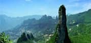
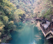
Huangshan (simplified Chinese: 黄山; traditional Chinese: 黃山; pinyin: Huángshān; literally: "Yellow Mountains"), is a mountain range in southern Anhui province in eastern China. The range is composed of material that was uplifted from an ancient sea during the Mesozoic era, 100 million years ago. The mountains themselves were carved by glaciers during the Quaternary. Vegetation on the range is thickest below 1,100 meters (3,600 ft), with trees growing up to the treeline at 1,800 meters (5,900 ft). The area is well known for its scenery, sunsets, peculiarly shaped granite peaks, Huangshan Pine trees, hot springs, winter snow, and views of the clouds from above. Huangshan is a frequent subject of traditional Chinese paintings and literature, as well as modern photography. It is a UNESCO World Heritage Site, and one of China's major tourist destinations. Huangshan is also the famous place for Chinese high quality teas, such as Huangshan Maofeng, Keemun Black and Blooming Tea.
Ma'anshan (simplified Chinese: 马鞍山; traditional Chinese: 馬鞍山; pinyin: Mǎ'ānshān), also written as Maanshan, is a prefecture-level city in the eastern part of Anhui province in Eastern China. An industrial city stretching across the Yangtze River, Ma'anshan borders Hefei to the west, Wuhu to the southwest, and Nanjing to the east. It is a core city of the Nanjing Metropolitan Circle. As of the 2010 census, Maanshan was home to 2,202,899 inhabitants whom 1,366,302 lived in the built-up area made of 3 urban districts and Dangtu County largely being urbanized. After the August 2011 administrative re-regionalization of Anhui Province, its population rose to 2.20 million, as 2 additional counties were placed under its administration (He and Hanshan).
Binzhou (simplified Chinese: 滨州; traditional Chinese: 濱州; pinyin: Bīnzhōu; literally: "coastal prefecture") is a prefecture-level city in northern Shandong province, People's Republic of China. Sitting on the northern bank of the Yellow River with two arms extended to the southern bank, Binzhou borders the provincial capital of Jinan to the southwest, Dezhou to the west, Zibo to the south, Dongying to the east, and the province of Hebei to the north. The city also has a short coastline bordering the Bohai Bay. Humans have been living in the area around Binzhou since the Neolithic era. It was called “Pugu country” in the Shang Dynasty, and was a county in the Qin Dynasty. It was first called Binzhou in era of the Five Dynasties because it borders the Bohai Sea. Nowadays, it has more than 3.7 million inhabitants. The major Industries are based on oil, chemicals and textiles.
Dongying (simplified Chinese: 东营; traditional Chinese: 東營; pinyin: Dōngyíng), a prefecture-level city, lies on the northern (Bohai Sea) coast of Shandong province, People's Republic of China. At the 2010 census, 2,035,338 people resided within its administrative area of 7,923.26 km2 (3,059.19 sq mi) and 998,968 in the built-up area made up of Dongying district and Kenli County largely being urbanized. Dongying is home to the Shengli Oilfield, which is, after Daqing (Heilongjiang), the second largest oilfield nationally.
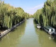
Liaocheng (Chinese: 聊城; pinyin: Liáochéng), also known as the Water City, is a prefecture-level city in western Shandong province, People's Republic of China. It borders the provincial capital of Jinan to the southeast, Dezhou to the northeast, Tai'an to the south, and the provinces of Hebei and Henan to the west. The Grand Canal flows through the city center. Its population was 5,789,863 at the 2010 census whom 1,229,768 lived in the built-up area made up of Donchangfu district, even though large parts remain rural. During the Song dynasty, the area of present-day Liaocheng included the prefectures of Bozhou (博州) and Jizhou (濟州). In 2007, the city is named China's top ten livable cities by Chinese Cities Brand Value Report, which was released at 2007 Beijing Summit of China Cities Forum.
Tai'an (Chinese: 泰安; pinyin: Tài'ān) is a prefecture-level city in western Shandong province. Centered on Mount Tai, the city borders the provincial capital of Jinan to the north, Laiwu to the northeast, Zibo to the east, Linyi to the southeast, Liaocheng to the extreme west and Jining to the south. To the west, Tai'an is separated from the province of Henan by the Yellow River. Its population was 5,494,207 as of the 2010 census, of whom 1,735,425 lived in the built-up (or metro) area made of 2 urban districts (Taishan District and Daiyue District).
Weihai (Chinese: 威海; pinyin: Wēihǎi; English: Port Edward) is a city in eastern Shandong province, People's Republic of China. It is the easternmost prefecture-level city of the province and a major seaport. Weihai borders Yantai to the west and the Yellow Sea to the east. Weihai's population is 2,804,800 at the 2010 census. Of those, 591,982 live in the built up area (Huancui urban district). Rongcheng, a county level city within Weihai, has a built up area with 1,006,795 inhabitants. The minor planet 207931 Weihai is named after this city. Between 1898 and 1930, the city was part of the British leased territory known as Weihaiwei or the Weihai Garrison (traditional Chinese: 威海衛; simplified Chinese: 威海卫; pinyin: Wēihǎi Wèi), and also between 1898 and 1930 the city itself was known as Port Edward and served as the capital of Weihaiwei.
Zaozhuang (simplified Chinese: 枣庄; traditional Chinese: 棗莊; pinyin: Zǎozhuāng) is a prefecture-level city in the south of Shandong province, People's Republic of China. The second smallest prefecture-level city in the province, it borders Jining to the west and north, Linyi to the east, and the province of Jiangsu to the south. Its population is 3,729,140 at the 2010 census whom 899,753 in the built-up area made of Shizhong and Yicheng districts.
Zibo (Chinese: 淄博; pinyin: Zībó) is a prefecture-level city in central Shandong province, People's Republic of China. It borders the provincial capital of Jinan to the west, Laiwu and Tai'an to the southwest, Linyi to the south, Weifang to the east, Dongying to the northeast, and Binzhou the north. Located in the centre of Shandong, Zibo is an important transportation hub. Zibo governs 5 districts (Zhangdian, Zichuan, Boshan, Zhoucun and Linzi) and each of these districts has a distinct downtown area of their own. The T-shaped city has a total area of 5,938 km2 (2,293 sq mi), including the counties of Huantai, Gaoqing, and Yiyuan. Zibo's total population was 4.53 million at the 2010 census, of which 3,633,239 inhabitants lived in the built-up area made of 5 urban districts (metro area) plus Huantai county largely being built. The built-up area is being conurbated with Zouping County in Binzhou municipality. Zibo was the centre of the ancient State of Qi, whose capital Linzi was the most populous city in the east about 3000 years ago. Zibo is the birthplace of ancient football Cuju, which according to FIFA, was the earliest form of the sport. Pu Songling, a well-known writer of the Qing Dynasty, is one of the most famous people from Zibo. As the birthplace of Qi Culture and because of the abundant natural resources, it is an excellent tourist city in China.
Jinhua (help·info), is a prefecture-level city in central Zhejiang province in eastern China. It borders the provincial capital of Hangzhou to the northwest, Quzhou to the southwest, Lishui to the south, Taizhou to the east, and Shaoxing to the northeast. Its population was 5,361,572 at the 2010 census including 1,077,245 in the built-up area made of two urban districts even though Lanxi City is also being conurbated soon. One can notice that the cities of Dongyang and Yiwu are now in the same agglomeration, a built-up area of 2,038,413 inhabitants bigger than the one of Jinhua itself. Jinhua is rich in red soil and forest resources. The Jinhua or Wu River flows through the Lan and Fuchun to the Qiantang River beside Hangzhou, which flows into Hangzhou Bay and the East China Sea. In mediaeval China, it formed part of the water network feeding supplies to the southern end of the Grand Canal. It is best known for its dry-cured Jinhua ham.
Changzhou (Chinese: 常州) is a prefecture-level city in southern Jiangsu province of China. It was previously known as Yanling, Lanling, Jinling, and Wujin. Located on the southern bank of the Yangtze River, Changzhou borders the provincial capital of Nanjing to the west, Zhenjiang to the northwest, Wuxi to the east, and the province of Zhejiang to the south. The city is situated in the affluent Yangtze Delta region of China. Its total population was 4,592,431 inhabitants at the 2010 census whom 3,290,918 lived in the built-up area made up of 5 urban districts. The agglomeration is now part of Shangai-Suzhou-Wuxi built-up area which has now more than 36,000,000 inhabitants, only second in China after Pearl River built-up area.
Huai'an (Chinese: 淮安; pinyin: Huái'ān), formerly called Huaiyin (simplified Chinese: 淮阴; traditional Chinese: 淮陰; pinyin: Huáiyīn) until 2001, is a prefecture-level city in central Jiangsu province of Eastern China. It borders Lianyungang, Suqian to the north, Yancheng to the northeast, Yangzhou to the southeast, and Chuzhou (Anhui) to the southwest. As of the 2010 census the municipality had 4,799,889 inhabitants, of whom 2,494,013 lived in the four urban districts.
Lianyungang (simplified Chinese: 连云港; traditional Chinese: 連雲港; pinyin: Liányúngǎng) is a prefecture-level city in northeastern Jiangsu province, People's Republic of China. It borders Yancheng to its southeast, Huai'an and Suqian to its south, Xuzhou to its southwest, and the province of Shandong to its north. Its name derives from Lian Island (formally Dongxilian Island) the largest island in Jiangsu Province which lies off its coastline, and Yuntai Mountain, the highest peak in Jiangsu Province, a few miles from its town center, and the fact that it is a port. Lianyungang (as Yuntai Mountain) was known in the West as Haichow (Wade–Giles romanization). This was one of the four original ports opened up for foreign trade in the 1680s by the Qing Dynasty Government. The others were Ningbo, Xiamen and Guangzhou.
Yangzhou (simplified Chinese: 扬州; traditional Chinese: 揚州; pinyin: Yángzhōu) is a prefecture-level city in central Jiangsu province in the People's Republic of China. Sitting on the northern bank of the Yangtze River, it borders the provincial capital of Nanjing to the southwest, Huai'an to the north, Yancheng to the northeast, Taizhou to the east, and Zhenjiang across the river to the south. Its population is 4,414,681 at the 2010 census and its built up area is home to 2,146,980 inhabitants including three urban districts plus currently in the agglomeration. Historically it is one of the wealthiest of China's cities, known at various periods for its great merchant families, poets, painters, and scholars. Its name (lit. "Rising Prefecture") refers to its former position as the capital of Yangzhou prefecture in imperial China.
Kaifeng (simplified Chinese: 开封; traditional Chinese: 開封; pinyin: Kāifēng; Wade–Giles: K'aifeng), known previously by several names (see below), is a prefecture-level city in east-central Henan province, People's Republic of China. It was once the capital of the Northern Song Dynasty. There are currently nearly 5 million people living in its metropolitan area. Located along the southern bank of the Yellow River, it borders the provincial capital of Zhengzhou to the west, Xinxiang to the northwest, Shangqiu to the east, Zhoukou to the southeast, Xuchang to the southwest, and the province of Shandong to the northeast.
Xinxiang (simplified Chinese: 新乡; traditional Chinese: 新鄉; pinyin: Xīnxiāng; Postal map spelling: Sinsiang) is a prefecture-level city in northern Henan province, People's Republic of China. It borders the provincial capital of Zhengzhou to its southwest, Kaifeng to its southeast, Hebi and Anyang to its north, Jiaozuo to its west, and the provinces of Shanxi and Shandong to its northwest and east respectively. Its population is 5,707,801 at the 2010 census of whom 902,731 are in the built-up area made of 3 out of 4 urban districts (Weibin, Hongqi and Muye). As the city is expanding very quickly, in a few years, Huixian and Weihui cities as well as Fengquan district and Xinxiang county will be added to the built-up area.
Enshi (Chinese: 恩施; pinyin: Ēnshī) is a county-level city in and the seat of Enshi Tujia and Miao Autonomous Prefecture, in western Hubei province, People's Republic of China. The prefecture's legislature, executive and judiciary are seated here, as well as its CPC and Public Security bureau. The entire county-level city of Enshi has an area of 3,967 square kilometres (1,532 sq mi) and a population of 780,000.
Huangshi (simplified Chinese: 黄石; traditional Chinese: 黃石; pinyin: Huángshí; literally: "yellow rock") is a prefecture-level city in southeastern Hubei province, People's Republic of China. Its population was 2,429,318 inhabitants at the 2010 census whom 1,601,687 in the built-up (or metro) area made of 4 urban district plus the city of Daye now being part of the agglomeration.
Jingzhou (Chinese: 荆州) is a prefecture-level city in southern Hubei, People's Republic of China, located on the banks of the Yangtze River. As of the 2010 census, its total population was 5,691,707, 1,154,086 of whom resided in the built-up (or metro) area comprising the two urban districts. Jingzhou's central urban area has grown out of a city historically known as Shashi; this name is preserved in the name of Shashi District, which includes the city's historical center, as well as in the names of a number of local facilities, such as Shashi Airport and a railway freight station.
Shiyan (Chinese: 十堰; pinyin: Shíyàn) is a prefecture-level city in northwestern Hubei province, People's Republic of China, bordering Henan to the northeast, Chongqing to the southwest, and Shaanxi to the north and west. At the 2010 census, its population was 3,340,841 whom 767,920 lived in the built-up (or metro) area ade of Maojian and Zhangwan urban districts on 1,193 km2. In 2007, the city was named China's top ten livable cities by Chinese Cities Brand Value Report, which was released at 2007 Beijing Summit of China Cities Forum.
Xianning (simplified Chinese: 咸宁; traditional Chinese: 咸寧; pinyin: Xiánníng) is a prefecture-level city in southeastern Hubei province, People's Republic of China, bordering Jiangxi to the southeast and Hunan to the southwest. It is known as the "City of Osmanthus".
Yichang (Chinese: 宜昌) is a prefecture-level city located in western Hubei province, People's Republic of China. It is the second largest city in the province after the capital, Wuhan. The Three Gorges Dam is located within its administrative area, in Yiling District. At the 2010 census, its population was 4,059,686 inhabitants whom 1,350,150 lived in the built-up (or metro) area made of Yiling, Xiling, Wujiagang and Dianjun urban districts as Xiating District is not conurbated yet.
Changde (Chinese: 常德; pinyin: Chángdé) is a prefecture-level city in the northwest of Hunan province, People's Republic of China, with a population of 5,717,218 as of the 2010 census, of which 1,232,182 reside in the urban districts of Dingcheng and Wuling. In addition to the urban districts, Changde also administers the county-level city of Jinshi and six counties. Changde is adjacent to Dongting Lake to the east, the city of Yiyang to the south, Wuling and Xuefeng Mountains to the west, and Hubei province to the north. The area has been inhabited by humans since around 8,000 years ago. In that time, the city has changed names several times, but it has been known as Changde since the twelfth century. The city is well known for the Battle of Changde during the Second Sino-Japanese War (1937–45) and the atrocities committed then by the Imperial Japanese Army.
Chenzhou (Chinese: 郴州; pinyin: Chēnzhōu) is a city located in the south of Hunan province, People's Republic of China. Its administrative area covers 19,317 square kilometres (7,458 sq mi), 9.2% of the provincial area, and its total population reached 4,559,600 in 2001, 26% of them living in urban areas, 74% of them live in rural areas.
Huaihua lies is in the mountainous west of Hunan, south-east of Zhangjiajie National Forest Park, and shares the same mountain belt. The area's rural poverty is a continuing problem. Railroads provide the main transportation in the region, although an airport was opened in 2004. Huaihua is home to the Second Artillery Corps Base 55, which is charged with maintaining ICBMs. The nuclear assets at Huaihua are intended for small-scale nuclear conflicts (with a limited, but nuclear, exchange), as well as the ability to strike Guam, one of only two B-2 bases.
Xiangtan (Chinese: 湘潭; pinyin: Xiāngtán; Wade–Giles: Hsiang-tan) is a prefecture-level city in Hunan province, China, located on the lower reaches of Xiang River. The hometowns of several founding leaders of the Chinese Communist Party, including Mao Zedong, Liu Shaoqi, and Peng Dehuai, are in the Xiangtan prefecture, as well as the hometowns of Qing dynasty painter Qi Baishi and scholar-general Zeng Guofan. As of 2010, it had 2,748,552 inhabitants, of whom 1,779,960 lived in the built-up area (2 urban districts plus Xiangtan county). Together with the four adjoining urban districts of Zhuzhou, its built-up area is home to 2,586,948 inhabitants. In 2007, the city is named China's top ten livable cities by Chinese Cities Brand Value Report, which was released at 2007 Beijing Summit of China Cities Forum.
Yueyang (simplified Chinese: 岳阳; traditional Chinese: 岳陽; pinyin: Yuèyáng) is a prefecture-level city at the northeastern corner of Hunan province, People's Republic of China, on the southern shores of Dongting Lake. Yueyang has an administrative area of 14,896 km2 (5,751 sq mi) and the city proper, 304 km2 (117 sq mi). The population was 5,477,911 at the 2010 census whom 991,465 lived in the built-up (or metro) area made up of Yueyanglou District and Yunxi District. The city's most famous attraction is the Yueyang Tower.
Zhuzhou (Chinese: 株洲; pinyin: Zhūzhōu), formerly Jianning, is a prefecture-level city of Hunan Province, People's Republic of China, a little to the southeast of Changsha and bordering Jiangxi to the east. It is part of the "ChangZhuTan Golden Triangle" (comprising the cities of Changsha, Zhuzhou and Xiangtan). The city has jurisdiction over 5 counties (Yanling, Chaling, Youxian, Liling, Zhuzhou) and four districts (Hetang, Lusong, Shifeng and Tianyuan, a high-tech industrial development zone), and covers an area of 11,420 km2 (4,410 sq mi). It had 3,855,609 inhabitants as of the 2010 census, of whom 806,988 lived in the built-up area (4 urban districts). With areas adjoining Zhuzhou due to be agglomerated in a few years' time, the joint built-up area will be home to 2,586,948 inhabitants. Zhuzhou is located in a subtropical monsoon climate zone and with its abundant mineral and organic resources has one of the highest agricultural yields in Hunan Province.
Ji'an (Chinese: 吉安; pinyin: Jí'ān) is a prefecture-level city in Jiangxi province, People's Republic of China, bordering Hunan to the west. It has an area of 25,219 km2 (9,737 sq mi) and as of the 2010 census, had a population of 4,810,339, of whom 538,699 live in the built-up (or metro) area made of 2 urban districts. The local speech is a variety of Gan Chinese. The former deputy governor of the People's Bank of China, Xiao Gang, is from here. This city is also the home of Jinggangshan University.
Jingdezhen, (or the Town of Jingde), is a prefecture-level city, previously a town, in northeastern Jiangxi province, People's Republic of China, with a total population of 1,554,000 (2007), bordering Anhui to the north. It is known as the "Porcelain Capital" because it has been producing quality pottery for 1700 years. The city has a well-documented history that stretches back over 2000 years.
Jiujiang (Chinese: 九江; pinyin: Jiǔjiāng), formerly transliterated Kiukiang or Kew Keang, is a prefecture-level city located on the southern shores of the Yangtze River in northwest Jiangxi Province, People's Republic of China. It is the second-largest prefecture-level city in Jiangxi province, after the provincial capital Nanchang. Jiujiang literally means "nine rivers". Its population was 4,728,778 inhabitants at the 2010 census whom 704,986 in the built up area made of 2 urban districts (Xunyang and Lushan). In 2007, the city is named China's top ten livable cities by Chinese Cities Brand Value Report, which was released at 2007 Beijing Summit of China Cities Forum.
Nanchang (Chinese: 南昌; pinyin: Nánchāng) is the capital of Jiangxi Province in southeastern China, located in the north-central portion of the province. It is bounded on the west by the Jiuling Mountains, and on the east by Poyang Lake. Because of its central location relative to the Yangtze and Pearl River Delta regions, it is a major railroad hub in Southern China. Its population was 5,042,566 whom 4,171,926 in the built-up area made up of six urban districts plus the urbanized counties of Nanchang and Xinjian. As the Bayi Riot 1927 was distinctively recognized by the ruling Communist Party as "firing the first gunshot against the evil Republic of China", the current communist regime has therefore named the city since 1949 "the City of Heroes", "the place where the People's Liberation Army was born", and the most widely known "place where the military banner of the People's Liberation Army was first raised".
Yichun (Chinese: 宜春; pinyin: Yíchūn; Wade–Giles: I2-ch'un1; Postal map spelling: Ichun) is a mountainous prefecture-level city in western/northwestern Jiangxi province, People's Republic of China, bordering Hunan to the west. Yichun literally means "pleasant spring". It is located in the northwest of the province along a river surrounded by mountains. Yichun has a history of over 2,200 years. It was established in 201 BC during the Han Dynasty. Yichun has a profound Buddhist culture. "Can Lin Qing Gui", the monastic rules for Buddhists at the Buddhist temple, originated from Yichun. Yichun is also the birthplace of many famous literary figures, such as Tao Yuanming and Deng Gu, both of whom are great poets from ancient times. The transportation in Yichun is convenient. The State Highway 320, State Highway 105, the Shanghai-Ruijin Highway and the Ganyue Highway (the Jiangxi-Guangdong Highway) construct a comprehensive traffic network in the city. A large sports complex with two stadiums was built in the 1990s and draws teams for sports competitions from all across China. Agriculture is the main industry but other natural resource industries such as timber and mining are extremely important for the economy. Major mineral deposits include aluminum, tungsten, gold, zinc, and copper. Yichun is also a stop along the major railway running between Beijing and Nanchang, the capital of Jiangxi.
Longyan (simplified Chinese: 龙岩; traditional Chinese: 龍岩; pinyin: Lóngyán; Pe̍h-ōe-jī: Lêng-nâ or Liong-nâ; literally: "dragon rock"; Hakka language: Liùng-ngàm) is a prefecture-level city in southwestern Fujian province, People's Republic of China, bordering Guangdong to the south and Jiangxi to the west.
Sanming (Chinese: 三明; pinyin: Sānmíng; Foochow Romanized: Săng-mìng)) is a prefecture-level city in western Fujian province, People's Republic of China. It borders Nanping City to the north, Fuzhou City to the east, Quanzhou City to the southeast, Longyan City to the south, and the province of Jiangxi to the west. Sanming lies between Wuyi and Daiyun mountains.
Zhangzhou (Chinese: 漳州; pinyin: Zhāngzhōu; Wade–Giles: Chang1-chou1; Pe̍h-ōe-jī: Chiang-chiu; formerly Lung-ch'i) is a prefecture-level city in southern Fujian province, People's Republic of China. Located on the banks of the Jiulong River (Beixi), Zhangzhou borders the cities of Xiamen and Quanzhou to the northeast, Longyan to the northwest and the province of Guangdong (Shantou City) to the southwest. Zhangzhou is home to 4,809,983 inhabitants at the 2010 census whom those of Longwen and Xiacheng districts are considered as urban. These two districts, together with Longhai and Xiamen, form a metropolitan area that, as of 2010, is home to about 5 million inhabitants. In older English works, its name may appear as Chang-chow or Changchow and in Southeast Asian contexts it appears as Chiang-chew or Chiang Chew from the Hokkien name.
Jiangmen (Chinese: 江门) is a prefecture-level city in Guangdong province in southern China with a population of about 4.45 million in 2010. The 3 urban districts are now part of Guangzhou – Shenzhen conurbation, probably the most important built-up area in the world called the Pearl River Delta Mega City with more than 44,78 million inhabitants at the 2010 census spread on 9 municipalities (including Macao) and 17,573 km2.
Meizhou is a prefecture-level city in eastern Guangdong province, People's Republic of China. It has an area of 15,864.51 km2 (6,125.32 sq mi), and a population of 4.33 million at the 2010 census. It comprises Meijiang District, Xingning City and six counties. Its built-up or metro area made up of 2 urban districts was home to 935,516 inhabitants at the 2010 census. Meizhou is honored with the titles of Hometown of Culture, Hometown of the Overseas Hakka Chinese and Hometown of Football.
Shàntóu (Chinese: 汕头), also known as Swatow or Suátao, is a prefecture-level city on the eastern coast of Guangdong province, People's Republic of China, with a total population of 5,391,028 as of 2010 and an administrative area of 2,064 square kilometres (797 sq mi). Shantou has direct jurisdiction over six districts and one county, and the six urban districts of Shantou has a population of 5,330,764. With it and the surrounding cities of Jieyang and Chaozhou, the metropolitan region known as Chaoshan covers an area of 10,404 km2 (4,017 sq mi), and had a permanent population of 13,937,897 at the end of 2010. It's built up area spread of 11 districts was home to 11,635,577 inhabitants at the 2010 census. Shantou, a city significant in 19th-century Chinese history as one of the treaty ports established for Western trade and contact, was one of the original Special Economic Zones of the People's Republic of China established in the 1980s, but did not blossom in the manner that cities such as Shenzhen, Xiamen and Zhuhai did. However, it remains eastern Guangdong's economic centre, and is home to Shantou University, a member of the Project 211 group.
Shaoguan (Chinese: 韶关), is a prefecture-level city in the north of Guangdong province, People's Republic of China, bordering Hunan to the northwest and Jiangxi to the northeast. It is home to the mummified remains of the sixth Zen Buddhist patriarch Huineng. Its built-up or metro area made up of Zhenjiang and Wujiang urban districts was home to 688,229 inhabitants at the 2010 census, Qujiang district not being conurbated yet.
Zhàoqìng (Chinese: 肇庆) is a prefecture-level city of Guangdong province, People's Republic of China and is considered part of the Pearl River Delta region. It is well known for being a regional tourist hub, a medium-sized provincial "college town" as well as an up-and-coming manufacturing center. Residents from Guangzhou, Shenzhen and other nearby cities, as well as people from Hong Kong and Macau, are known to visit the city on weekend getaways and excursions. Its population was 3,918,467 at the 2010 census whom 1,232,462 lived in the built-up (or metro) area made of Duanzhou urban District and Gaoyao County largely being urbanized. Dinghu urban District is not yet conurbated. The main central city, excluding Seven Star Crags, is fairly flat, but thickly forested mountains lie just outside the city limits. Numerous rice paddies and aquaculture ponds are found on the outskirts of the city.
Zhuhai (Chinese: 珠海; pinyin: Zhūhǎi) is a prefecture-level city on the southern coast of Guangdong province in China. Located in the Pearl River Delta, Zhuhai borders Jiangmen to the northwest, Zhongshan to the north, and Macau to the south. Zhuhai was one of the original Special Economic Zones established in the 1980s. Zhuhai is also one of China's premier tourist destinations, being called the Chinese Riviera. The city's population is made up of mostly Mandarin speaking migrants. Its northern part made of Xiangzhou district is now part of the Guangzhou-Shenzhen built-up area, the biggest built-up area in the world with more than 44,478,513 inhabitants at the 2010 census encompassing the whole Shenzhen, Dongguan, Foshan, Zhongshan, Macao cities, main part of Guangzhou, and small parts of Jiangmen and Huizhou cities. According to the Chinese Academy of Social Sciences, Zhuhai is the most livable city in China.
Baise (Chinese: 百色; local pronunciation: paːk˧˥ ɬɐk˥) is the westernmost prefecture-level city of the Guangxi Zhuang Autonomous Region, People's Republic of China, bordering Vietnam as well as the provinces of Guizhou and Yunnan.
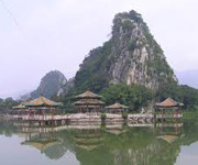
Guilin is a prefecture-level city in the northeast of the Guangxi Zhuang Autonomous Region, China, situated on the west bank of the Li River, and bordering Hunan to the north. Its name means, "Forest of Sweet Osmanthus", owing to the large number of fragrant Sweet Osmanthus trees located in the city. The city has long been renowned for its scenery of karst topography and is one of China's most popular tourist destinations.
Liuzhou (柳州), is a prefecture-level city in north-central Guangxi Zhuang Autonomous Region, People's Republic of China. The prefecture's population was 3,758,700 in 2010, including 1,436,599 in the built-up area made of 4 urban districts. Its total area is 18,777 km2 (7,250 sq mi) and 667 km2 (258 sq mi) for built up area.
Qinzhou (simplified Chinese: 钦州; traditional Chinese: 欽州; pinyin: Qīnzhōu) is a prefecture-level city in Guangxi, People's Republic of China, lying on the Gulf of Tonkin and having an urban population of 944,000. The area originally belonged to Guangdong. The city was originally a county Qinxian (Chinese Postal Map Romanisation: Yamhsien). From the beginning of the present era, Qinzhou (Wade-Giles: K'in-chou] was for many centuries "the center of Chinese overland trade with Indo-China".
Wúzhōu (Chinese: 梧州; Jyutping: Ng⁴zau¹), other names include Wuchow (Chinese Postal Map Romanization), and Ngchow (historically romanised name), is a prefecture-level city in the east of Guangxi Zhuang Autonomous Region, People's Republic of China. Wuzhou is located in eastern Guangxi bordering Guangdong province. It is at the confluence of the Gui River and the Xun River where they form the Xi River; 85% of all water in Guangxi flows through Wuzhou. The total area of Wuzhou is 12,588 km2 (4,860 sq mi).
Hǎikǒu (Chinese: 海口), is the capital and most populous city of Hainan province, People's Republic of China. It is situated on the northern coast of Hainan, by the mouth of the Nandu River. The northern part of the city is the district of Haidian Island, which is separated from the main part of Haikou by the Haidian River, a branch of the Nandu. Administratively, Haikou is a prefecture-level city, comprising four districts, and covering 2,280 square kilometres (880 sq mi). There are 2,046,189 inhabitants in the built up area all living within the 4 urban districts of the city. Haikou was originally a port city. Today, more than half of the island's total trade still goes through its ports. The city is home to Hainan University, which has its main campus on Haidian Island.
Guìyáng (Chinese: 贵阳) is the capital of Guizhou province of Southwest China. It is located in the centre of the province, situated on the east of the Yunnan–Guizhou Plateau, and on the north bank of the Nanming River, a branch of the Wu River. The city has an elevation of about 1,100 meters. It has an area of 8,034 square kilometres (3,102 sq mi). Its population is 4,324,561 at the 2010 census whom 3,037,159 live in the built up area made of 7 urban districts.
Leshan (simplified Chinese: 乐山; traditional Chinese: 樂山; pinyin: Lèshān; literally: "Happy mountain"; Sichuanese Pinyin: No2san1; local pronunciation: [nʊʔ˧sã˥]) is a prefecture-level city located at the confluence of the Dadu and Min rivers in Sichuan Province, People's Republic of China. Leshan is located on the southwestern fringe of the Red Basin in southern Sichuan, about 120 km (75 mi) from Chengdu. At the 2010 census, its population was 3,235,759 whom 662,814 lived in the built-up (or metro) area made of Shizhong district, as Wutongqiao and Jinkouhe districts are not conurbated yet.
Mianyang (simplified Chinese: 绵阳; traditional Chinese: 綿陽; pinyin: Miányáng) is the second largest prefecture-level city of Sichuan province in Southwest China. Its population was 4,613,871 at the 2010 census covering an area of 20,267.46 square kilometres (7,825.31 sq mi) consisting of Jiangyou, a county-level city, six counties and two urban districts. Its built-up (or metro) area was home to 1,722,133 inhabitants including the city proper of Mianyang (two urban districts) and An County largely being conurbated as urbanisation sprawls. In 2006, Mianyang was ranked as China's third "most suitable city for living" by China Daily, after coastal cities Dalian and Xiamen.
Ya'an (Chinese: 雅安; pinyin: Yǎ'ān; Wade–Giles: Ya-an, Tibetan: Yak-Nga [གཡག་རྔ་]) is a prefecture-level city in the western part of Sichuan province, People's Republic of China, located just below the Tibetan Plateau.
Luzhou (simplified Chinese: 泸州; traditional Chinese: 瀘州; pinyin: Lúzhōu; Sichuanese Pinyin: Nu2zou1; Luzhou dialect: [nu˨˩tsəu˥]), formerly transliterated as Lu-chou or Luchow, is a prefecture-level city located in the southeast of Sichuan Province, People's Republic of China. The city, named Jiangyang until the Southern and Northern Dynasties, is known as the "wine city". Situated at the confluence of the Tuo River and the Yangtze River, Luzhou is not only an important port on the Yangtze river, but also the largest port in both size and output in Sichuan province since Chongqing seceded from Sichuan province in 1997. At the 2010 census its population was 4,218,427 inhabitants whom 919,832 lived in the built-up (or metro) area made of Jiangyang and Longmatan districts, as Naxi district isn't conurbated yet. Luzhou, which borders Yunnan, Guizhou and Chongqing, is the only geographic junction of the four provinces, and was therefore the logical place for a port in ancient China. After the PRC was founded in 1949, Luzhou became the capital of southern Sichuan province. In 1983, Luzhou was approved as a prefecture-level city administratively.
Dali City (Chinese: 大理市; pinyin: Dàlǐ shì; Bai: Darl•lit; Hani: Dafli) is a county-level city in and the seat of the Dali Bai Autonomous Prefecture, in northwestern Yunnan province, People's Republic of China. Dali is one of the most popular tourist destinations in Yunnan, known for its natural scenery and historical and cultural heritage.
Yuxi (Chinese: 玉溪; pinyin: Yùxī) is a prefecture-level city in the Yunnan province of the People's Republic of China. The administrative center of Yuxi is Hongta District. Yuxi is approximately 90 kilometres (56 mi) south of Kunming.
Lánzhōu (simplified Chinese: 兰州; traditional Chinese: 蘭州; Postal map spelling: Lanchow) is the capital and largest city of Gansu Province in Northwest China. A prefecture-level city, it is a key regional transportation hub, allowing areas further west to maintain railroad connections to the eastern half of the country. Lanzhou is home to 3,616,163 inhabitants at the 2010 census and 2,177,130 in the built-up area (urban) of 1,088 square kilometres (420 sq mi).
Yinchuan is the capital of the Ningxia Hui Autonomous Region, People's Republic of China, and former capital of the Western Xia Empire of the Tanguts. It has an area of 4,467 km (2,776 mi) and a total population of 1.99 million. Its built up area is home to 1,290,170 inhabitants spread on 3 urban districts. The name of the city literally means "silver river"; the character for "river" (Chinese: 川; pinyin: chuān) is the same as that in Sichuan, but not as those in, for example, the Yellow River (simplified Chinese: 黄河; traditional Chinese: 黃河; pinyin: Huánghé) or Yangtze River (simplified Chinese: 长江; traditional Chinese: 長江; pinyin: Chángjiāng).
Baoji (help·info) (simplified Chinese: 宝鸡; traditional Chinese: 寶雞; pinyin: Bǎojī) is a prefecture-level city in western Shaanxi province, People's Republic of China.
Ürümqi (/uːˈruːmtʃi/, literally "beautiful pasture", from Mongolian), is the capital of Xinjiang Uyghur Autonomous Region of the People's Republic of China in the northwest of the country. Urumqi was a major hub on the Silk Road during China's Tang dynasty, and developed its reputation as a leading cultural and commercial center during the Qing dynasty. With a built-up (or metro) population of 2,988,715 as of 2010 census (6 urban and suburban districts but Dabancheng not yet urbanized) and 3.03 million in 7 urban and suburban districts, Ürümqi is the largest city in China's western interior. Since the 1990s Ürümqi has developed economically and now serves as a regional transport node, cultural, and commercial centre.
Dezhou (Chinese: 德州; pinyin: Dézhōu) is a prefecture-level city in northwestern Shandong province, People's Republic of China. It borders the provincial capital of Jinan to the southeast, Liaocheng to the southwest, Binzhou to the northeast, and the province of Hebei to the north.
Anshan (Chinese: 鞍山; pinyin: Ānshān; literally: "saddle mountain") is the third largest prefecture level city in Liaoning province, People's Republic of China. Situated in the central area of the province, Anshan is about 92 kilometres (57 mi) south of Shenyang, the provincial capital. Anshan is on the boundary between the Mountains of eastern Liaoning and the plains of the west. The prefecture has a population of 3,584,000 people and covers an area of about 9,252 km2 (3,572 sq mi). The distance from the east to the west of the prefecture is 133 km (83 mi). The area contains the famous Qianshan National Park. The city's name is derived from the shape of a nearby mountain that resembles the shape of a horse's saddle, which can be seen on the left (west) about five minutes before the northbound train arrives at Anshan Station. Anshan is home to the Anshan Iron and Steel Group, one of the largest steel producers in China. Anshan is sister cities with Sheffield Anshan has a population of 3.65 million at the 2010 census. Anshan holds one third of the worlds supply of talcum. Anshan holds a quarter of the worlds reserves of magnesite. Anshan also produced the largest ever jade stone, now a local tourist attraction carved as a Buddha. The built up area encompassing 4 Anshan urban districts (1,529,350 inhabitants) and urban Liaoyang is home to more than 2.17 million inhabitants in 2010.
Shaoxing (help·info) is a prefecture-level city on the southern shore of Hangzhou Bay in northeastern Zhejiang province, China. It was formerly known as Kuaiji and Shanyin and abbreviated in Chinese as 越 (Yuè) from the area's former inhabitants. Located on the south bank of the Qiantang River estuary, it borders Ningbo to the east, Taizhou to the southeast, Jinhua to the southwest, and Hangzhou to the west. The city itself is lined with numerous canals and waterways, giving it a classic Jiangnan style scenery though more mountainous than is typical for Jiangnan. At the 2010 census, its population was 4,912,339 inhabitants whom 1,914,683 (Keqiao and Yuecheng districts) lived in the built-up area of Hangzhou-Shaoxing, with 8,156,154 inhabitants. Shaoxing has long been a hotbed of Chinese cultural activity, producing such luminary figures as Wang Xizhi, Zhou Enlai, Lu Xun, and Cai Yuanpei. It is widely known throughout China for Shaoxing wine, meigan cai, and stinky tofu, and was recently featured on A Bite of China. Its local variety of Chinese opera sung in the local dialect and known as Yue or Shaoxing opera is second in popularity only to Peking opera. In 2010, Shaoxing celebrated the 2500th anniversary of the founding of the city. Economically, the city's driven by manufacturing of textiles, electronics, and energy efficient lighting. Zhejiang has the fifth highest per capita GDP in the nation, with the city itself at 32nd nationally by GDP per capita.
Jiaxing (Chinese: 嘉兴; pinyin: Jiāxīng; Wu Chinese: Gāshīng [kɑɕiŋ]) is a prefecture-level city in northern Zhejiang province, People's Republic of China. Lying on the Grand Canal of China, Jiaxing borders Hangzhou to the southwest, Huzhou to the west, Shanghai to the northeast, and the province of Jiangsu to the north. At the 2010 census, its population was 4,501,657 and its built-up area made of 2 urban districts was home to 1,201,882 inhabitants.
Wuhu (simplified Chinese: 芜湖; traditional Chinese: 蕪湖; pinyin: Wúhú; literally "Weedy Lake") is a prefecture-level city in southeastern Anhui province, People's Republic of China. Sitting on the southeast bank of the Yangtze River, Wuhu borders Xuancheng to the southeast, Chizhou and Tongling to the southwest, Hefei to the northwest, Ma'anshan to the northeast, and the province of Jiangsu to the east, and is approximately 90 km (56 mi) southwest of Nanjing. Its population was 3,545,067 inhabitants at the 2010 census whom 1,264,539 in the built-up (or metro) area made of 3 out of 4 urban districts (all but Sanshan not yet continuously urbanized).

 Immediate attention